✕ Home
For Buyers Buyer Guide Move Up Quiz 5-Mistakes Guide Mortgage Calculator Rent vs Buy Rate Alerts Buyer Checklist
For Sellers Seller Guide Valuation Net Proceeds Calculator Seller Checklist Why Sell with Jesse
About Reviews Let's Talk →
California · Riverside County

Temescal Valley Homes,
By the Numbers.

Temescal Valley is an unincorporated community of about 26,232 people in Riverside County, near Corona, Rancho Santa Margarita and Norco. I help buyers and sellers across Southern California, Temescal Valley included.

The real community boundary
26K
Residents
8,475
Homes, 2020 Census
3
Public Schools
The place

The Story of
Temescal Valley.

Temescal Valley is a unincorporated community of about 26,232 people in Riverside County.

For green space, Temescal Valley has 4 parks, led by Deleo Regional Sports Park at roughly 38 acres. Golfers have Glen Ivy Golf Club.

For a day out there is Cowboy Gunfighters Show, Live Music and Magic Show. There are 3 public schools inside the boundary, run by Corona-Norco Unified.

Assembled from the U.S. Census Bureau, Wikidata, OpenStreetMap and the California Department of Education. Photo credits.
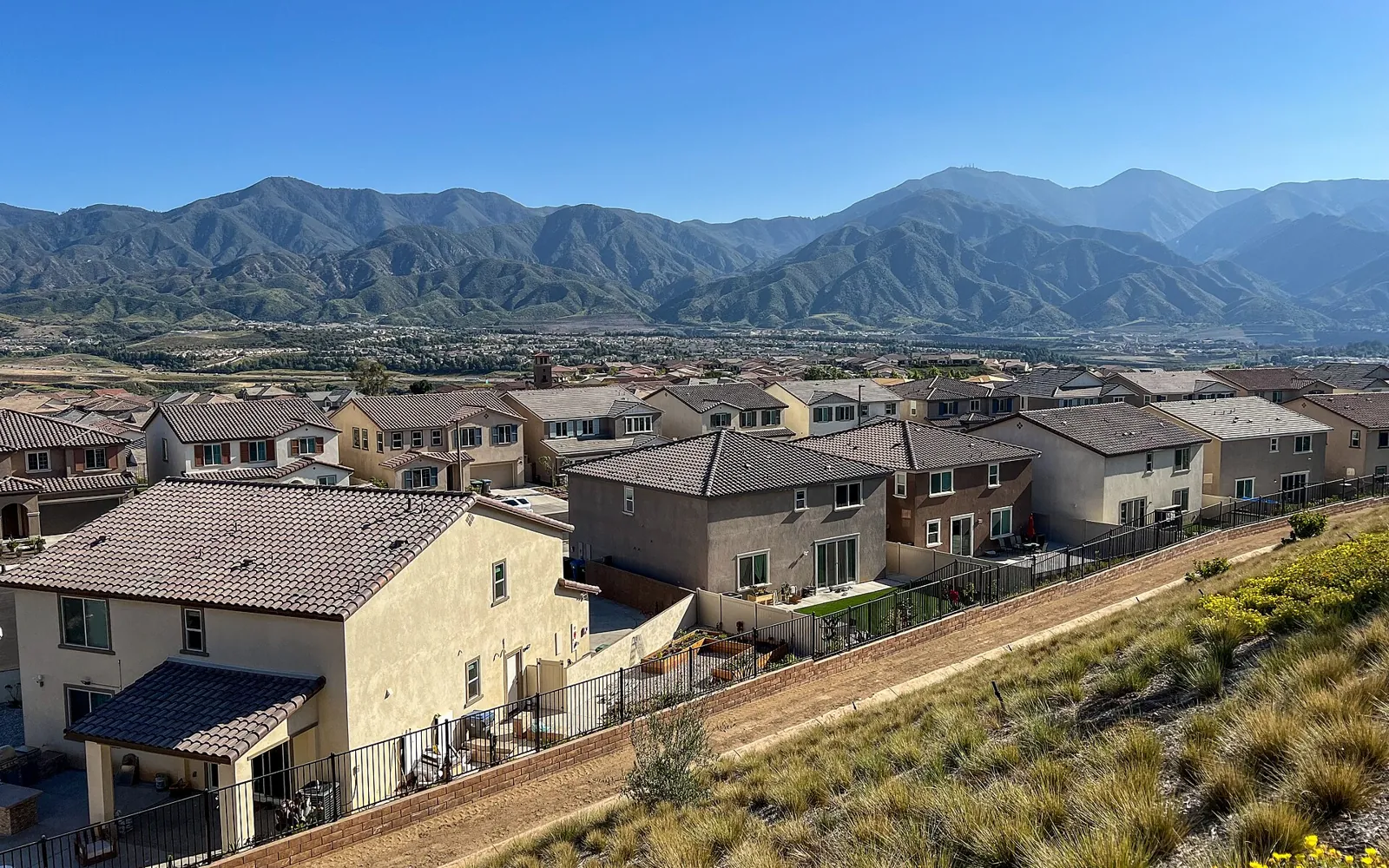
Homes in Temescal Valley with the Santa Ana Mountains behind them.
Temescal Valley
26,232People, 2020 Census
4Parks
56Acres of parks
3Public schools
5Places to eat
Outdoors

Parks and Open Space
in Temescal Valley.

4 parks, about 56 acres of them in all. Sizes are measured from each park's mapped outline. Tap any park to see it on the map.

ParkDeleo Regional Sports Park38 acres
ParkCoral Canyon Park9.1 acres
ParkTerramor Park4.8 acres
ParkMontecito Ranch Park3.8 acres
Golf courseGlen Ivy Golf Club
Weekends

Things to Do and
Places to Hang Out.

Real places inside Temescal Valley. Tap any one to see it on the map.

Attractions

  • Shooting Gallery
  • Tom's Mining Company
  • Tractor Driving
  • Train Ride

Theme park

  • Tom's Farms

Theaters

  • Cowboy Gunfighters Show
  • Live Music
  • Magic Show
Food and drink

Where Temescal Valley
Eats and Drinks.

5 places are on the map inside Temescal Valley: 3 bars, 2 restaurants. 5 of them are local, not chains.

Local spots on the map

  • The Sportsman's BarBar
  • Tom's Old-Fashioned BurgersBurgers
  • Cheese and Wine Shoppe / Patio PizzaRestaurant
  • Marquee 15 - Concert, Entertainment, & Dinner TheaterBar
  • RockefellasBar

Listed from OpenStreetMap, not a ranking or a recommendation. Restaurants open and close, so check hours before you go.

Temescal Valley on the Map.

The outline is the official community boundary. The dots are its public schools, parks, things to do and local food. Tap the chips to show or hide each kind. Pick any nearby city to open its guide.

3 public schools inside the Temescal Valley boundary

3Elementary

School district: Corona-Norco Unified.

See every school by name

Elementary

  • Dr. Bernice Jameson Todd Elementary
  • Luiseno
  • Temescal Valley Elementary

Counted from the California Department of Education school directory by each campus location. Which school a home is assigned to depends on the address, so confirm with the district before you buy.

Temescal Valley Questions,
Answered.

How many public schools are in Temescal Valley?

3 public schools sit inside the Temescal Valley boundary: 3 elementary. They belong to Corona-Norco Unified. School assignment depends on the home address, so confirm with the district.

What are the biggest parks in Temescal Valley?

Temescal Valley has 4 parks. The largest are Deleo Regional Sports Park (about 38 acres), Coral Canyon Park (about 9.1 acres) and Terramor Park (about 4.8 acres). Sizes are measured from OpenStreetMap.

What cities are near Temescal Valley?

Temescal Valley is in Riverside County. The closest cities I cover are Corona, Rancho Santa Margarita, Norco and Lake Forest.

How do I find out what my Temescal Valley home is worth?

Enter your address on the home valuation form at jessetek.net/valuation. You get an automated estimate right away and a Comparative Market Analysis from Jesse within 24 hours, with no obligation.

Population: U.S. Census Bureau, 2020 Census. Schools: California Department of Education public school directory. Parks, places and restaurants: OpenStreetMap contributors. Boundary: U.S. Census Bureau.